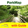
Rock Creek Park - GPS Map Navigator


Detailed App Info:
Application Description
___________
Version 3.3
___________
Rock Creek Park is the best place where visitors can Hike, Bike, Picnic, Fish, Horse ride also play many sports or attends concert shows. Kids can participate in a wide range of special programs at Rock Creek Park, including planetarium shows, animal talks, exploratory hikes, crafts, and junior ranger programs.
Park map are extremely advanced embedded electronic charts with all information collected from the National/State Park and Forest Services and many other local sources. The maps contain all trails (Hiking, Biking, Equestrian trails etc.,) and Points of interests (POI), Lookout points, Eating places, Ranger Stations, Picnic areas etc.
Map Features:
•Search Favorites using Co-ordinates
•Insert Unlimited Favorites
•Navigation Compass
•Insert Waypoint and see your Speed, Distance towards Destination
•Find Angle towards Destination
•Gps Functionality
•Offline Maps Overlay
•On/Off Names for clear Display
•Geo-Tagged Photo Management
………………………………………more
………………..A Tourist guide is also provided for quick user reference……………
“Enjoy Great Voyages”
Note:
"Continued use of GPS running in the background can dramatically decrease battery life."
"Turn off GPS when not in use"
Requirements
Your mobile device must have at least 13.71 MB of space to download and install Rock Creek Park - GPS Map Navigator app. Rock Creek Park - GPS Map Navigator is available on iTunes for $5.99
If you have any problems with installation or in-app purchase, found bugs, questions, comments about this application, you can visit the official website of Flytomap at http://www.flytomap.com.
Copyright © 2011 FlyToMap