Europe High Altitude Enroute Charts


Detailed App Info:
Application Description
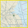
Enroute charts for entire Western Europe. These are moving maps of Europe that include High Altitude Instrument Flight Rule (IFR) Charts.
EUROCONTROL Regional Charts (ERC) combines Airspace Management Planning Charts (ASM) and the Central Flow Management Planning Charts (CFMU). They are available in 13 areas over Europe in the Upper Airspace charts.
Features:
Moving maps of entire europe.
All maps are included.
Add custom waypoint / markers on map for route planning.
Requirements
Your mobile device must have at least 297.06 MB of space to download and install Europe High Altitude Enroute Charts app. Europe High Altitude Enroute Charts is available on iTunes for $1.99
If you have any problems with installation or in-app purchase, found bugs, questions, comments about this application, you can visit the official website of SendFreeFax.net Gamini Gurusinghe at http://airplanegroundschools.com/iphone/europe-enroute-charts-iphone-app.php.
Copyright © AirplaneGroundSchools.com