Altamaha River Guide


Detailed App Info:
Application Description
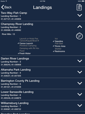
Just over 100 miles long, the Altamaha River is formed by the confluence of the Ocmulgee and Oconee Rivers just east of Lumber City. Critical habitat is found here for bald eagles, swallow-tailed kites and red-cockaded woodpeckers. The waterway is flush with wildlife, and not the first man-made dam. Boat ramps and landings facilities are located in each county as well as a range of services from bait and tackle shops to picnic areas and marked hiking trails.
This app provided by the Altamaha River Partnership features:
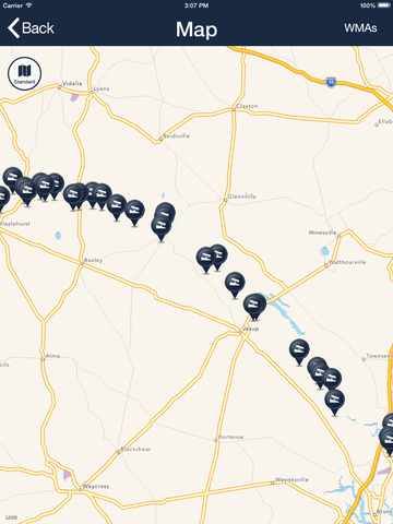
GPS Enabled Mapping
WMA Areas Defined on Map
Locations of River Landings with Available Amenities
Listings of Local Outfitters
Tourist Information
Water Levels
Events Along the River
Web and Social Media Connection
This app is for reference only and should not be used as the only source of navigation. All boundaries and locations are approximate.
This app provided by the Altamaha River Partnership features:
GPS Enabled Mapping
WMA Areas Defined on Map
Locations of River Landings with Available Amenities
Listings of Local Outfitters
Tourist Information
Water Levels
Events Along the River
Web and Social Media Connection
This app is for reference only and should not be used as the only source of navigation. All boundaries and locations are approximate.
Requirements
Your mobile device must have at least 10.71 MB of space to download and install Altamaha River Guide app. Altamaha River Guide is available on iTunes for $0.00
If you have any problems with installation or in-app purchase, found bugs, questions, comments about this application, you can visit the official website of Sorta Precision Technologies SORTA PRECISION TECHNOLOGIES, LLC at http://www.populaceinc.com.
Copyright © Populace Inc